InterOil Corporation Exploration PAPUA NEW GUINEA THE NEXT GLOBAL LNG SUPPLIER David Holland Exploration Manager November, 2010
Exploration Presentation Napa Napa November 20, 2010 4
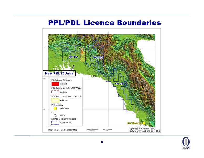
Licencing Update InterOil has three (3) Petroleum Propecting Licences currently in their second year of their extended term A draft of PRL 15 was formally accepted November 15, 2010 and currently awaiting award PRL15 will unify the Elk…
PPL/PDL Licence Boundaries New PRL15 Area 6
Exploration Strategy
Looking Back 2010 marks 11 years of InterOils exploration in Papua New Guinea. InterOil began exploration in Papua New Guinea with an initial licence award in April of 1999. InterOil took a contrarian view and saw evidence of an under…
Systematic Exploration Focus With such a large frontier license a systematic approach was required to focus our efforts and leverage cost effective data acquisition techniques The aim: to gain maximum knowledge at minimum…
Photogeological Mapping Detailed geological maps compiled from legacy geological data and interpretation of airphotos, Landsat and S.A.R. 10
Geological Mapping Historical and InterOil Surface Geological Database Over 2,000 kilometres of detailed mapping in addition to a legacy dataset from earlier explorers that has been digitally captured 11
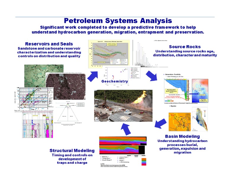
Petroleum Systems Analysis Significant work completed to develop a predictive framework to help understand hydrocarbon generation, migration, entrapment and preservation. Geochemistry 12
Improved Understanding of Petroleum System Better definition of Reservoirs Better understanding of the Late Cretaceous Pale and Subu Sandstone potential Proven onshore extension of the Reef/Platform System as a northern extension of…
Airborne Gravity and Magnetics Airborne Gravity and Magnetics Surveys Year Suvey Line Km's Sub Total 2003 Falcon Survey 6,217 6,217 2005 Puri Longhorn 5,879 5,879 2006 Upper Aure (9) 4,302 Lower Aure (J) 2,149 Reef-Gas Leads (8)…
Airborne Gravity and Magnetics Coverage 22,253 km of data acquired in four airborne surveys Also PPL236 15
Airborne Gravity and Magnetics Coverage Data Gaps Data Gaps Data Gaps Data Gaps to be filled 16 with a new Airborne Program in Early 2011
Leads and Prospects Exploration Inventory The end product is defined leads and prospects. Currently we have data gaps to be filled by Airborne Gravity and follow up surface geological mapping 17
InterOil Wells InterOil has drilled a total of 12 wells - 2 Stratigraphic 6 Exploration, and 5 Appraisal 20
Well Summary 12 wells 6 Exploration (Elk-4a), 5 Appraisal and 2 Stratigraphic Well Name Target Well Type Result Subu-1 Pale and Subu Sandstone (sst) Stratigraphic Excellent reservoir quality and residual hydrocarbons (bitumen) Subu-2…
Current Seismic Activity Wolverine Program Seismic to attempt to mature a drillable prospect Bwata Program Appraisal of the Bwata Gas Field discovered in 1960 by APC Petroleum 22
Looking Forward Planning Additional Airborne Geophysical Survey in PPL237 and PPL238 first Quarter of 2011 Preparing for an Exploration Well to potentially spud Q1 2011 Commitment Seismic program in PPL236 over the Barracuda, Tuna and…
Reef Potential Leads and Prospects Tsoma Trend Anomalies Outcropping Saw Mtns Reefs Bwata West Wolverine Antelope Field BigHorn Zebra Seismosaurus Mackeral (Kapuri Nth) Tuna 24
 Loading...