Exploring Eastern Africa Africa Oil and Gas Conference October 2014 1
Exploring Eastern Africa Who is Rift Energy Why East Africa History of an exploration asset: Block L19 Kenya Growing the portfolio lessons learned 2
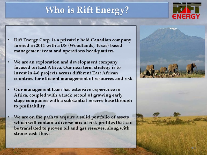
Who is Rift Energy Rift Energy Corp. is a privately held Canadian company formed in 2011 with a US (Woodlands, Texas) based management team and operations headquarters. We are an exploration and development company focused on…
Business Focus We are focused on evaluating and acquiring onshore oil and gas concessions in East Africa. During the period of early stage exploration, we evaluate projects for technical and commercial risks, providing a deal…
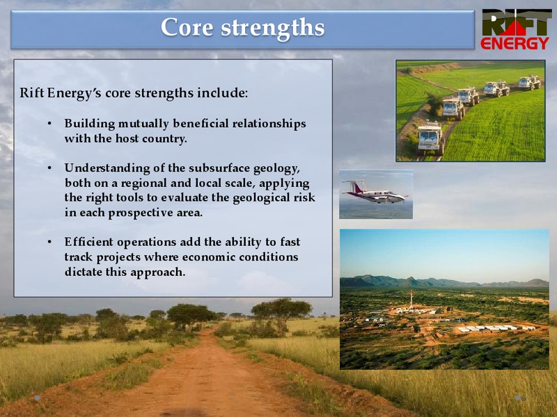
Core strengths Rift Energys core strengths include: Building mutually beneficial relationships with the host country. Understanding of the subsurface geology, both on a regional and local scale, applying the right tools to…
Why East Africa Significant oil reserves exist in most East African countries, but a number of challenges exist: Some, like South Sudan, have long term production and strong potential, but political changes have slowed the pace of…
History of an exploration Asset In June 2012, Rift Energy signed a Production Sharing Contract (PSC) covering Block L19 in southeastern Kenya. Block L19 covers approximately 12,000 KM2 (2.9 million acres) within the Lamu Basin.…
Technical Work Program The goal of our technical work program covering Block L19 is to reduce the risks for hydrocarbon exploration. We conduct ongoing technical studies through the Evaluation Telescope to understand the geological…
Technical Work Program (continued) Basin and regional modeling of petroleum systems provide some insight into these risks. Airborne Gravity and Magnetic Surveys provide a large scale picture of the regional and basin risks.…
History of an exploration Asset Building a Technical Framework: Block L19 1) Aerial Gravity and Magnetic Survey Data was collected across the entire block at 2kmx 10km spacing. An interpreted depth to basement map indicated a…
History of an exploration Asset Building a Technical Framework: Block L19 1) Aerial Gravity and Magnetic Survey An interpreted depth to basement map indicated a large basement structure over 50 km in length traversing the block…
History of an exploration Asset 2) Geochemical Survey To determine if these potential structures were charged with hydrocarbons, a surface geochemical survey using Amplified Geochemical Imaging was performed. The objectives of…
Geochemical Study The data was acquired using a proprietary membrane in a similar form also used with GORE-TEX fabrics. The membrane has pores engineered small enough to keep soil particles and water from entering that are about 1000…
Geochemical Study (continued) The samples were deployed for 20 days and were subsequently collected and sent back to the laboratory to be analyzed. As a result of the laboratory analysis, significant zones of various hydrocarbon types…
History of an exploration Asset 3 ) Cores recovered from Ria Kulai well The Ria Kalui well was drilled in 1961 and 1962 by Mehta Oil Exploration company to a depth of 1,561 meters. The well was suspended and subsequently abandoned…
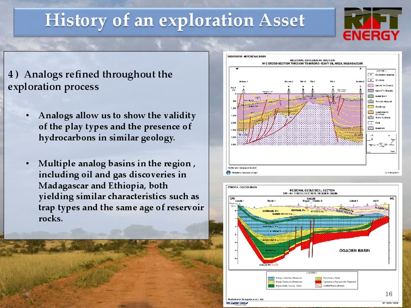
History of an exploration Asset 4 ) Analogs refined throughout the exploration process Analogs allow us to show the validity of the play types and the presence of hydrocarbons in similar geology. Multiple analog basins in the…
History of an exploration Asset 5) 2-D seismic program Our work commitment on the block requires at least 500 line Km of 2-D seismic during the first exploration period. Based on the previous technical studies, a 2-D seismic…
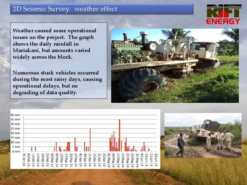
2D Seismic Survey: weather effect Weather caused some operational issues on the project. The graph shows the daily rainfall in Mariakani, but amounts varied widely across the block. Numerous stuck vehicles occurred during the most…
2D Seismic Survey: mapping structural traps Prior to seismic mapping, expected geological models and trap types were developed showing possible structure and trap styles expected to be identified by the 2D seismic survey. BACK TILTED…
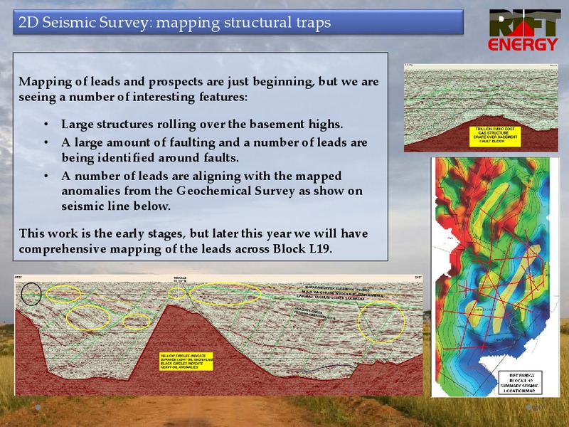
2D Seismic Survey: mapping structural traps Mapping of leads and prospects are just beginning, but we are seeing a number of interesting features: Large structures rolling over the basement highs. A large amount of faulting and a…
History of an exploration Asset Milestones for the First Two Year Exploration Period: Identify a series of leads and prospects to guide further exploration programs and to reach the drillable prospect stage. Targets going forward…
Assist, Support, and Protect An important part of our work in any area we work is in leaving a positive impact on the local communities. These activities include: Assist the local communities by supporting projects that improve the…
CSR Projects Rift Energy is committed to Community projects as part of its work in Kenya. We continue to assist the communities in many ways with employment and procuring of local supplies where possible. We have identified a number of…
Community Projects: We have ten projects ongoing across our block We are building six school houses with desks. We have four water access projects All projects are having a large positive impact on the local communities.…
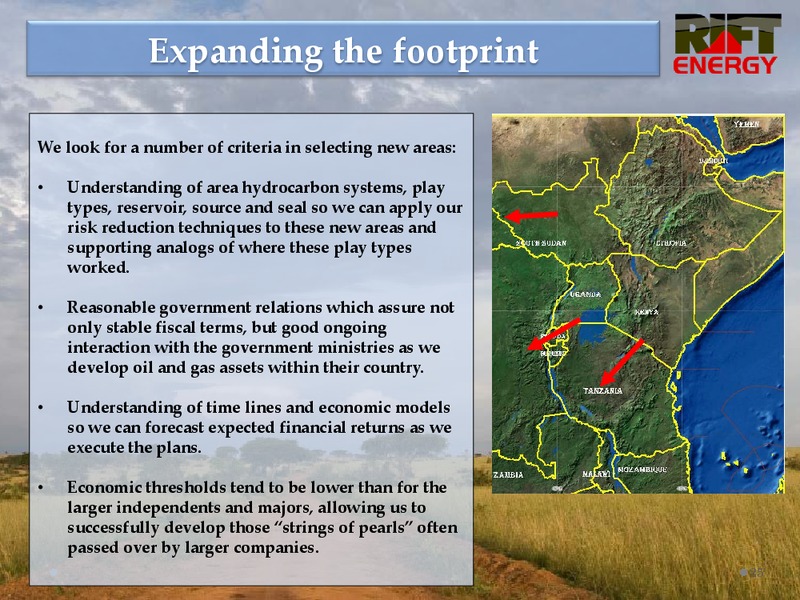
Expanding the footprint We look for a number of criteria in selecting new areas: Understanding of area hydrocarbon systems, play types, reservoir, source and seal so we can apply our risk reduction techniques to these new areas and…
Lessons Learned Exploration programs must be designed to address all key exploration risks including source seal and reservoir, with risk reduction being a continuous process, with newly added data points continuously adding more…
Summary We continue to understand our concession and reduce risks as we develop leads and prospects to reach drillable status. We continue to evaluate new concessions in the area, with a similar risk reduction program to quickly…
 Loading...