Montana North Dakota Middle Member Bakken Play Julie A. LeFever North Dakota Geological Survey
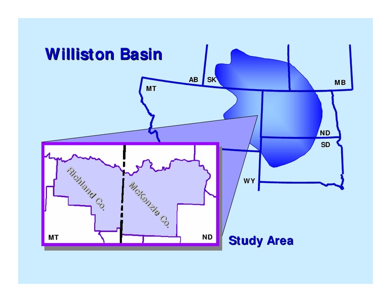
Williston Basin AB SK MB MT ND SD Ri WY ch la M nd cK en Co zi . e Co . MT ND Study Area
Bakken Formation Geology Stratigraphy Lithology Depositional Environments/History Age Source Rock Potential
Stratigraphy Three Forks Formation (Devonian) Conformable & Unconformable 250 ft thick Shales, dolostones, siltstones, and sandstones Sanish Sand Sublittoral to supralittoral
10608 ft. SESW Sec. 13, T.23N.,R.56E. AHEL 1 H8 Nevins Three Forks Fm.
Stratigraphy Bakken Formation Nomenclature Defined in 1953 Amerada Petroleum - 1 H.O. Bakken Restricted to the Subsurface 105 ft thick upper and lower shale middle limestone member
Isopach of the Bakken Formation
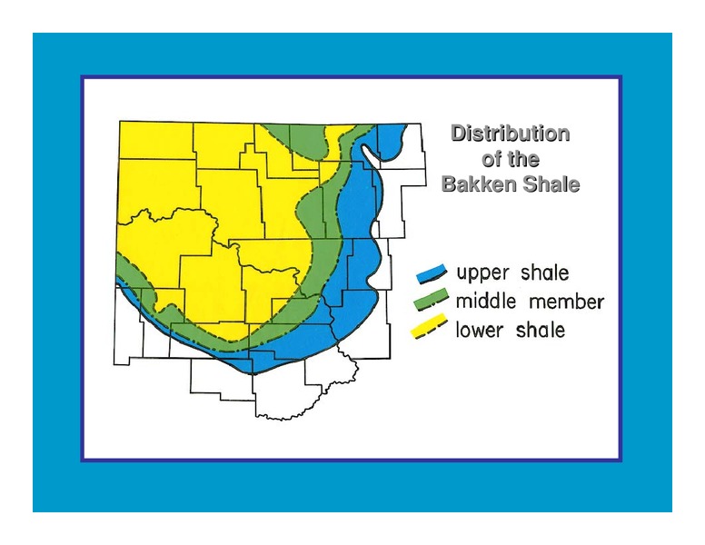
Distribution of the Bakken Shale
Stratigraphy Bakken Formation z Lithology z Lower Shale Member z 50 ft thick z Dark brown to black, fissile, non-calcareous, organic-rich shale z Quartz, pyrite z fossils - conodonts, algal spores, brachiopods, fish teeth, bones,…
Isopach of the Lower Bakken Shale
10604.5 ft. SESW Sec. 13, T.23N.,R.56E. AHEL 1 H8 Nevins Bakken/Three Forks Contact
Stratigraphy Bakken Formation z Middle Member z 85 ft thick z 5 different lithofacies z Calcareous siltstone to sandstone, dolostone, silty limestone, and oolitic limestone z Locally productive
Isopach of the Middle Bakken Member
Lithofacies of the Middle Member Upper Shale Lithofacies 5 - Siltstone Lithofacies 4 Interbedded Dark Grey Shale and Buff Silty Sandstone Lithofacies 3 - Sandstone Productive Lithofacies 2 Interbedded Dark Grey Shale and Buff…
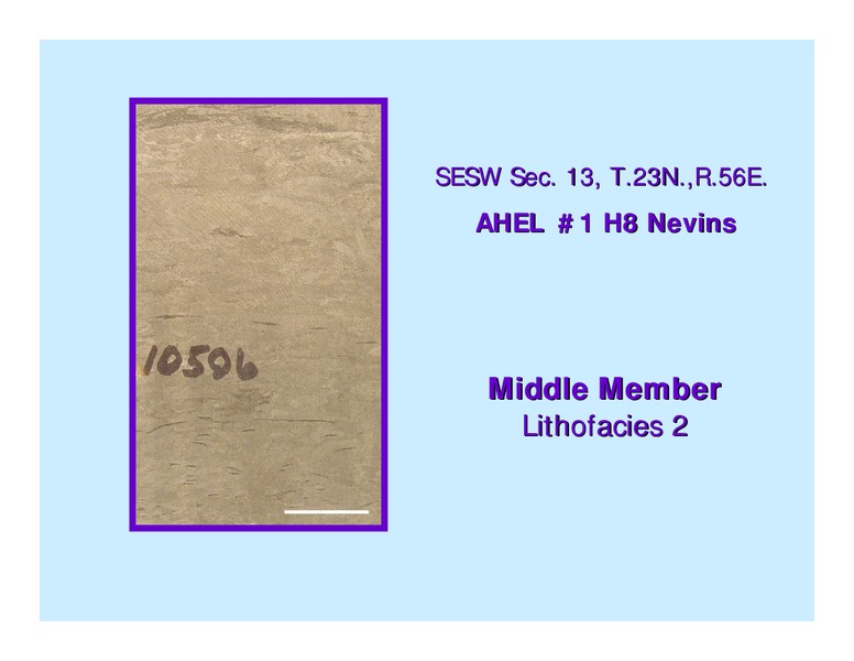
SESW Sec. 13, T.23N.,R.56E. AHEL 1 H8 Nevins Middle Member Lithofacies 2
10585 ft. SESW Sec. 13, T.23N.,R.56E. AHEL 1 H8 Nevins Middle Member Lithofacies 2
10582 ft SESW Sec. 13, T.23N.,R.56E. AHEL 1 H8 Nevins Upper Shale/Middle Mbr Contact
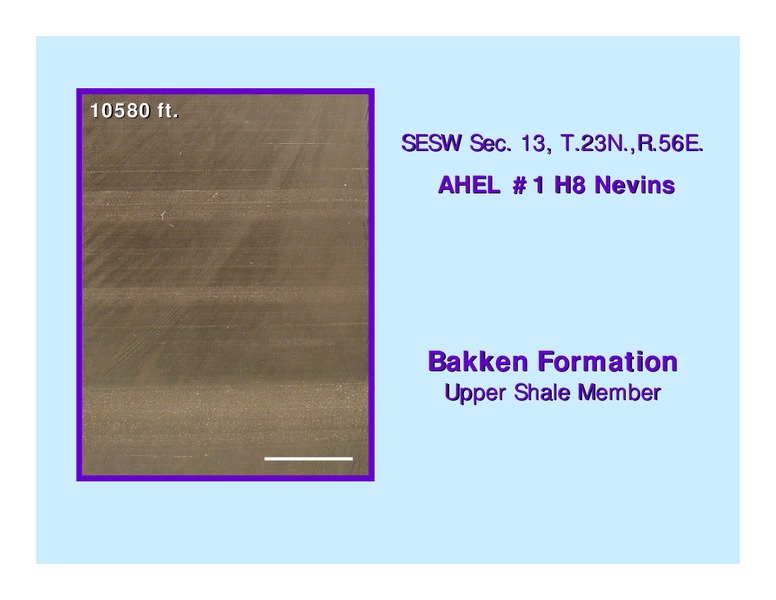
Stratigraphy Bakken Formation z Upper Member z Maximum extent of the Bakken z 23 ft thick z Conformable and Unconformable z Laminated to massive with poorly sorted beds of silt-sized material z Lag sandstone
Isopach of the Upper Bakken Shale
10580 ft. SESW Sec. 13, T.23N.,R.56E. AHEL 1 H8 Nevins Bakken Formation Upper Shale Member
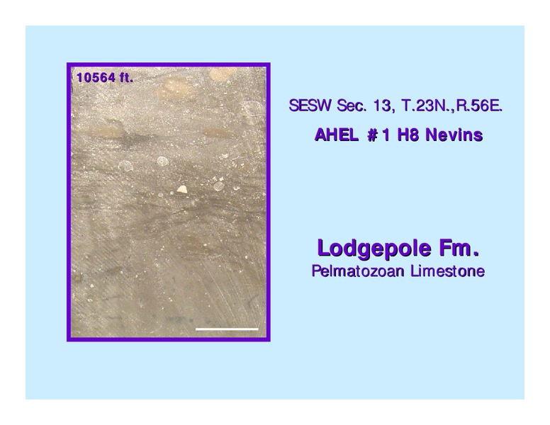
Stratigraphy Lodgepole Formation Conformable 900 ft thick False Bakken; Pelmatozoan Limestone 5 major lithofacies representing a marine transgression
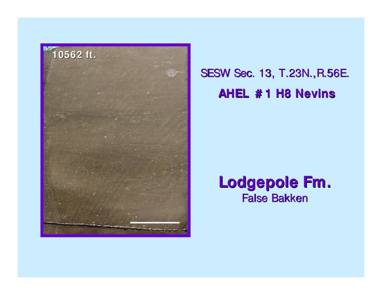
False Bakken
10562 ft. SESW Sec. 13, T.23N.,R.56E. AHEL 1 H8 Nevins Lodgepole Fm. False Bakken
10564 ft. SESW Sec. 13, T.23N.,R.56E. AHEL 1 H8 Nevins Lodgepole Fm. Pelmatozoan Limestone
Bakken Formation Depositional Environments/Age Stratified water column offshore, marine environment Bakken Shales Anoxic bottom conditions Middle Member Aerobic marine to marginal marine conditions Devonian/Mississippian
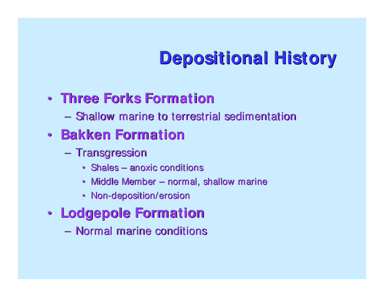
Depositional History Three Forks Formation Shallow marine to terrestrial sedimentation Bakken Formation Transgression Shales anoxic conditions Middle Member normal, shallow marine Non-deposition/erosion Lodgepole Formation…
Source Rock Potential Total Organic Content 0 to 40% Decrease towards depositional edge Kerogen 70-90% amorphous 0-20% herbaceous 30% coaly 5% woody Formed in subaquatic oxygen-restricted environment
Source Rock Potential Hydrocarbon Generation Depth of 9000 ft 100o C Volume of Oil Generated Up to 413 billion barrels (ND & MT)
Immature Onset of Generation Intense Generation Source Rock Maturity Zones
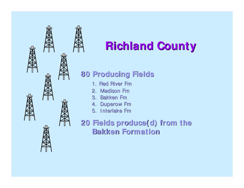
Richland County 80 Producing Fields 1. Red River Fm 2. Madison Fm 3. Bakken Fm 4. Duperow Fm 5. Interlake Fm 20 Fields produce(d) from the Bakken Formation
Bakken Formation Richand County, MT Historically 46 wells have produced from the Bakken + a few commingled wells Currently 31 wells reported production in 2000 Total production for 2000 = 145,323 bbls oil
Richland County 1. 555 Wells Examined in Richland County 2. Data Included: 1. Last Charles Salt 2. Lower Lodgepole 3. Bakken Formation 4. Porosity zone 5. Three Forks Formation 6. Devonian Prairie Salt 3. Combined with Existing…
Formation Limits Bakken Formation Upper Middle Lower Prairie Salt Edge Montana North Dakota
Isopach of the Bakken Formation 140 ft 130 120 110 Contour Interval 100 90 80 70 60 50 40 30 20 10 0 Montana North Dakota
Isopach of the Lower Member Bakken Formation Bakken Limit 50 ft 45 40 35 Contour Interval 30 25 20 15 10 5 0 Montana North Dakota
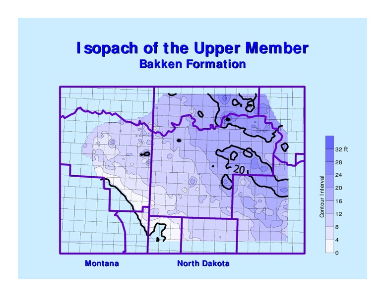
Isopach of the Upper Member Bakken Formation 32 ft 28 24 Contour Interval 20 16 12 8 4 0 Montana North Dakota
Isopach of the Middle Member Bakken Formation 70 ft 65 60 55 Contour Interval 50 45 40 35 30 25 20 15 10 5 0 Montana North Dakota
Balcron Oil - 44-24 Vaira SESE Sec. 24, T.24N., R.54E. GR Density Porosity Lodgepole Fm. 10000 upper Bakken Fm. middle Three Forks Fm. Neutron Porosity
Bakken Middle Member Porosity Zone Porosity Zone Contours 70 ft 65 60 55 Contour Interval 50 45 40 35 30 25 20 15 10 5 0 Montana North Dakota
Bakken Middle Member Prairie Salt Prairie Salt Edge 70 ft 65 60 55 50 Contour Interval 45 40 35 30 25 20 15 10 5 0 Montana North Dakota
Bakken Middle Member Prairie Salt Prairie Salt 70 ft 65 60 55 Contour Interval 50 45 40 35 30 25 20 15 10 5 0 Montana North Dakota
Middle Member Porosity Zone 12 % 10 Contour Interval M 8 cK en 6 Ri zi ch e la Co 4 nd . Co 2 . 0 Contour Interval: 2 ft.
Bakken Middle Member Sandstone Unit Ri ch 20 ft la nd Co M 16 . cK Contour Interval en zi e 12 Co . 8 4 0 Montana North Dakota
Shell Oil Company - 12-6-44 U.S.A. SENWNW Sec. 6-T.148N.-R.104W. Density Porosity GR Lodgepole Fm. Upper Bakken Fm. Shale 10600 Middle Mbr Three Forks Fm. Neutron Porosity
Can the Bakken Play Extend into North Dakota YES Production from the same interval Mappable log characterisitics from MT into ND Prominent trends illustrated on Bakken maps Other intervals within the middle member that have…
 Loading...