
What is the Uinta Basin?
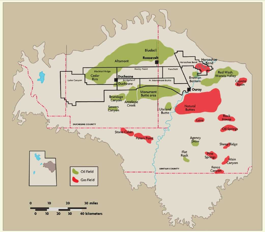
The Uinta Basin, located in northeastern Utah, has produced 577 MMbbls since its discovery in 1949 and is characterized by naturally fractured, tight oil sands with multiple zones. Our operations are primarily focused on developing the Altamont Field (including the Bluebell and Cedar
Rim fields), which is the largest field in the basin.
The Uintah Basin, also spelled Uinta Basin, is a physiographic section of the larger Colorado Plateaus province, which, in turn, is part of the larger Intermontane Plateaus physiographic division.[1] It is also a geologic structural basin in eastern Utah, east of the Wasatch Mountains and south of the Uinta Mountains. The Uintah Basin is fed by creeks and rivers flowing south from the Uinta Mountains.
Uinta Basin Drilling Activity - Permits

More Uinta Basin Drilling Permits

Uinta Basin Oil Production Barrels Per Day (bbls/d) (as of 12/31/2019)

Uinta Basin Production Equivalent daily (boe/d)

Uinta Basin Play News
-
Large E&P Chops Permian/Anadarko Basin Frac Activity by 30% In 2024
February 28,2024 -
Crescent Energy Company First Quarter 2023 Results
May 11,2023 -
Crescent Energy 4Q, Full Year 2022 Results; Maintenance Capital for 2023
March 09,2023 -
Crescent Energy Co. Second Quarter 2022 Results
August 10,2022 -
Ovintiv Trims Bakken, Uinta Portfolio; Sells Off Properties for $250 Million
July 06,2022 | Crescent Energy Company -
Crescent Energy Co. First Quarter 2022 Results
May 13,2022 -
Crescent Energy Wraps Up $690MM Acquisition of Uinta Basin Assets
March 30,2022 -
Greylock Energy Picks Up Acreage Position in Uinta/Green River Basins
March 08,2022 | Crescent Energy Company -
Ovintiv Inc. Fourth Quarter, Full Year 2021 Results
February 28,2022